Have You Ever Seen This Strange Building Spotted in Wyoming?
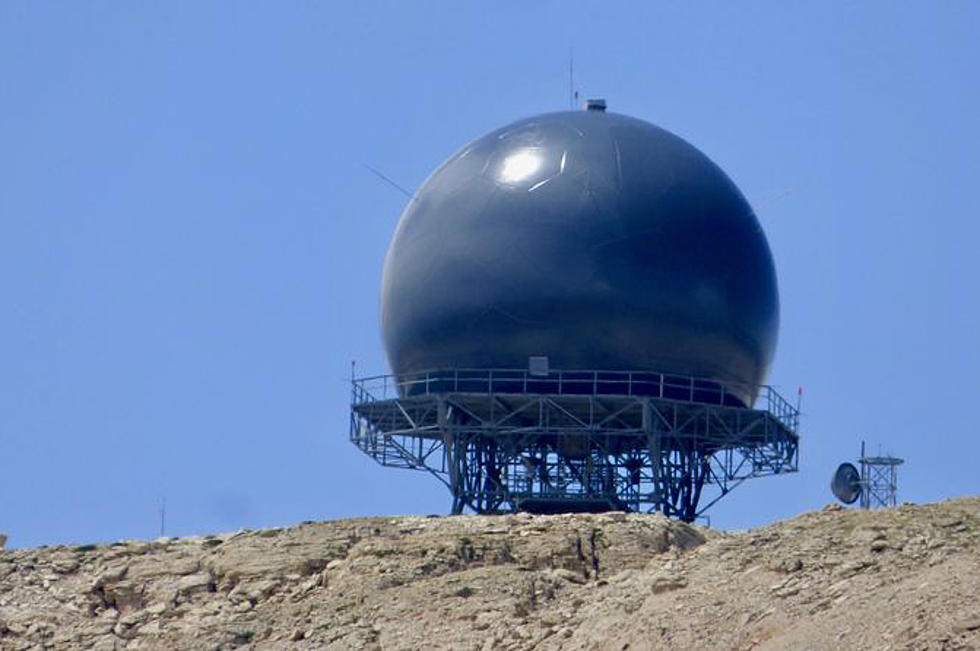
No, this is not a giant soccer ball. Nor is it leftover from some science fiction movie filmed in Wyoming. This is the Lovell FAA Radar Site atop Medicine Mountain. The spherical shaped building is actually radar used by the Federal Aviation Administration. To be specific this building is a Long Range Radar system that has been in use since the 60s. In other words, this building is used for GPS and turn-by-turn navigation for airplanes. According to FortWiki, the Lovell FAA Radar Site can track aircraft from 200 miles.
A lot of the details about this building are classified as part of its operations are guided by Homeland Security, but we do know a few things about the facility. It was built in 1962. That installation was in used until upgraded in 2012. Around then it became part of the Common Air Route Surveillance Radar. Looking at old photos, the dome was once white like a golf ball. Now it is black. Why? That appears to be classified.
The installation has been a concern to some residents of Wyoming. Some groups are concerned because of how close it was to Medicine Wheel National Historic Landmark.
Photo Used Under Creative Commons
Peculiar building on Medicine Mountain - Bighorn National Forest... anyone know what it is? from r/wyoming
More From 107.9 Jack FM